Those Markers We See So Often
They Sometimes Blend Into The Background
What are they all about, where are they located throughout our County, and what the heck do they say?
Shucks, you never have time to read them when you're driving by.We reckon the best way to describe the the markers would be to borrow the wording from the
West Virginia Division of Culture and History's website:
The West Virginia Highway Historical Marker Program was initiated in 1937 as part of the New Deal as a way to encourage tourism during the Great Depression. The West Virginia Commission on Historic and Scenic Markers worked with the State Road Commission, Works Progress Administration, and Federal Emergency Relief Administration to place 440 markers during the first year alone. After World War II, markers were placed at the sites of most state-run facilities and schools. The West Virginia Historic Commission took over the program in 1963. Since the late 1960s, the program has been managed by West Virginia Archives and History, which is today part of the West Virginia Division of Culture & History.
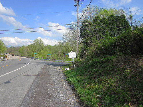
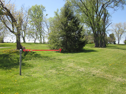
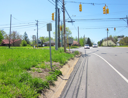
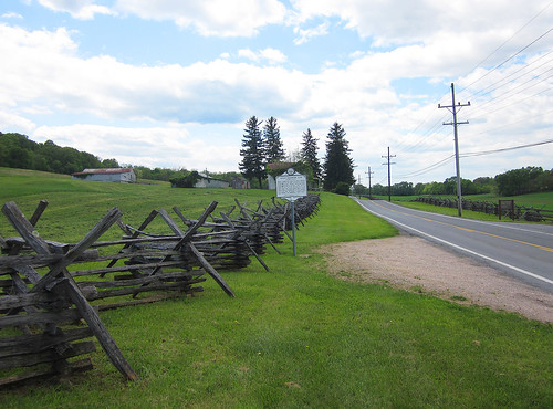
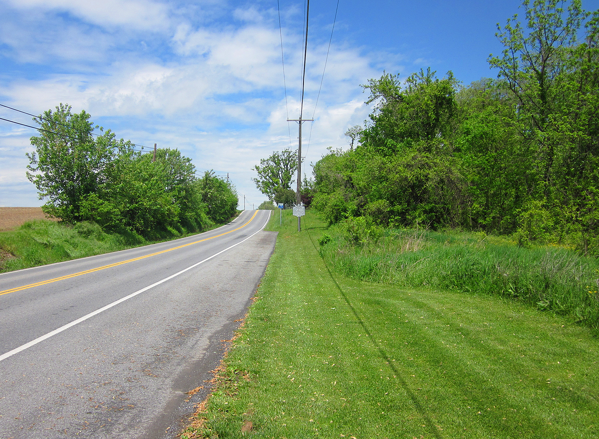
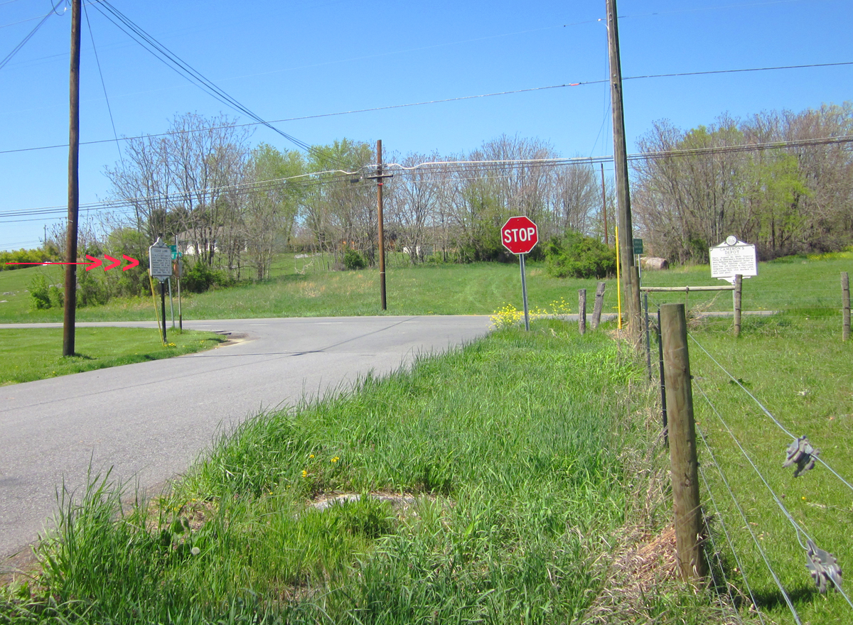
We've noticed the markers as we're sure you have. Some are in good condition, some are nearly illegible, and some are MIA. Many are in places some distance from the historical sites they describe. We're on a quest to find all that remain. You are invited to join in the hunt. We'd like a photo of the marker from a distance, a closeup that can be easily read (if it's not illegible), and a photo of the site that it references (if applicable).
We'll arrange them alphabetically for the time being waiting for a better suggestion.
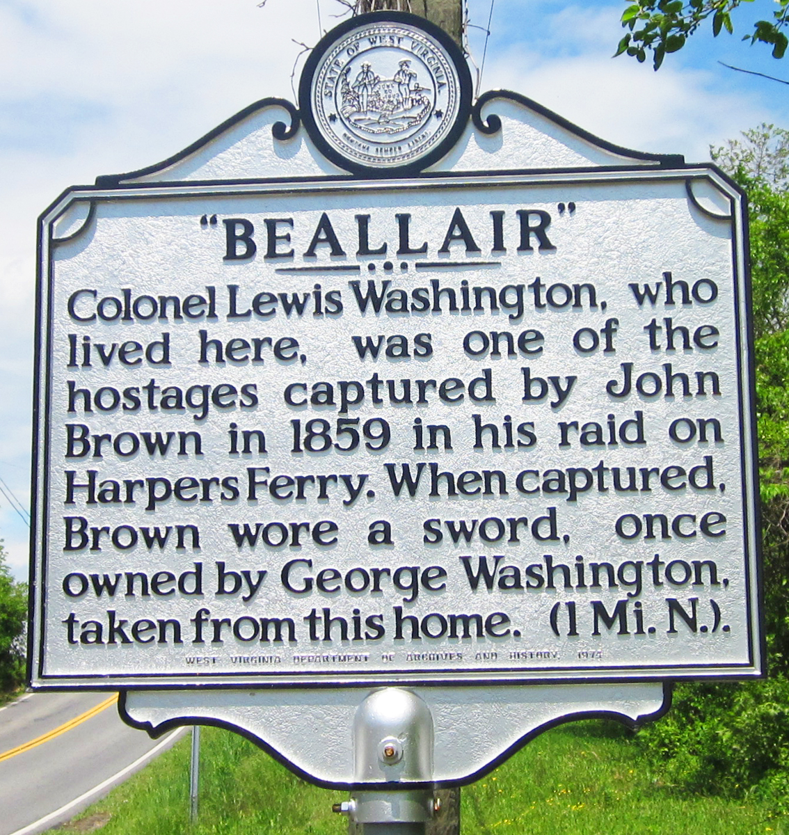
Bellair


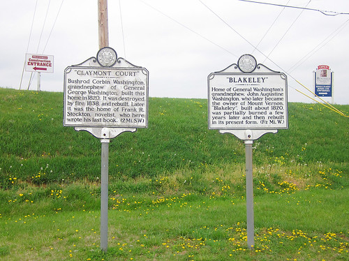
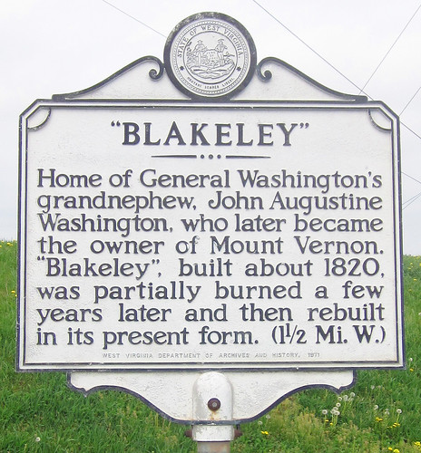
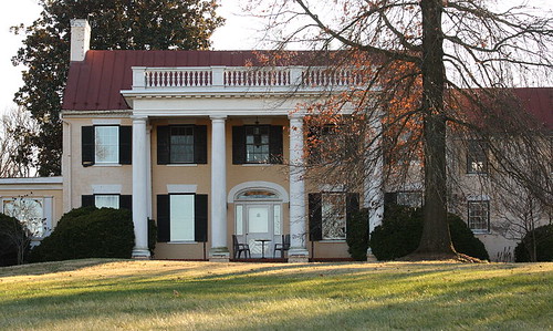
Blakeley
Blakeley from Wikipedia
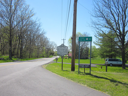
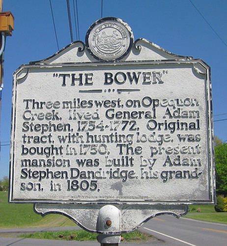
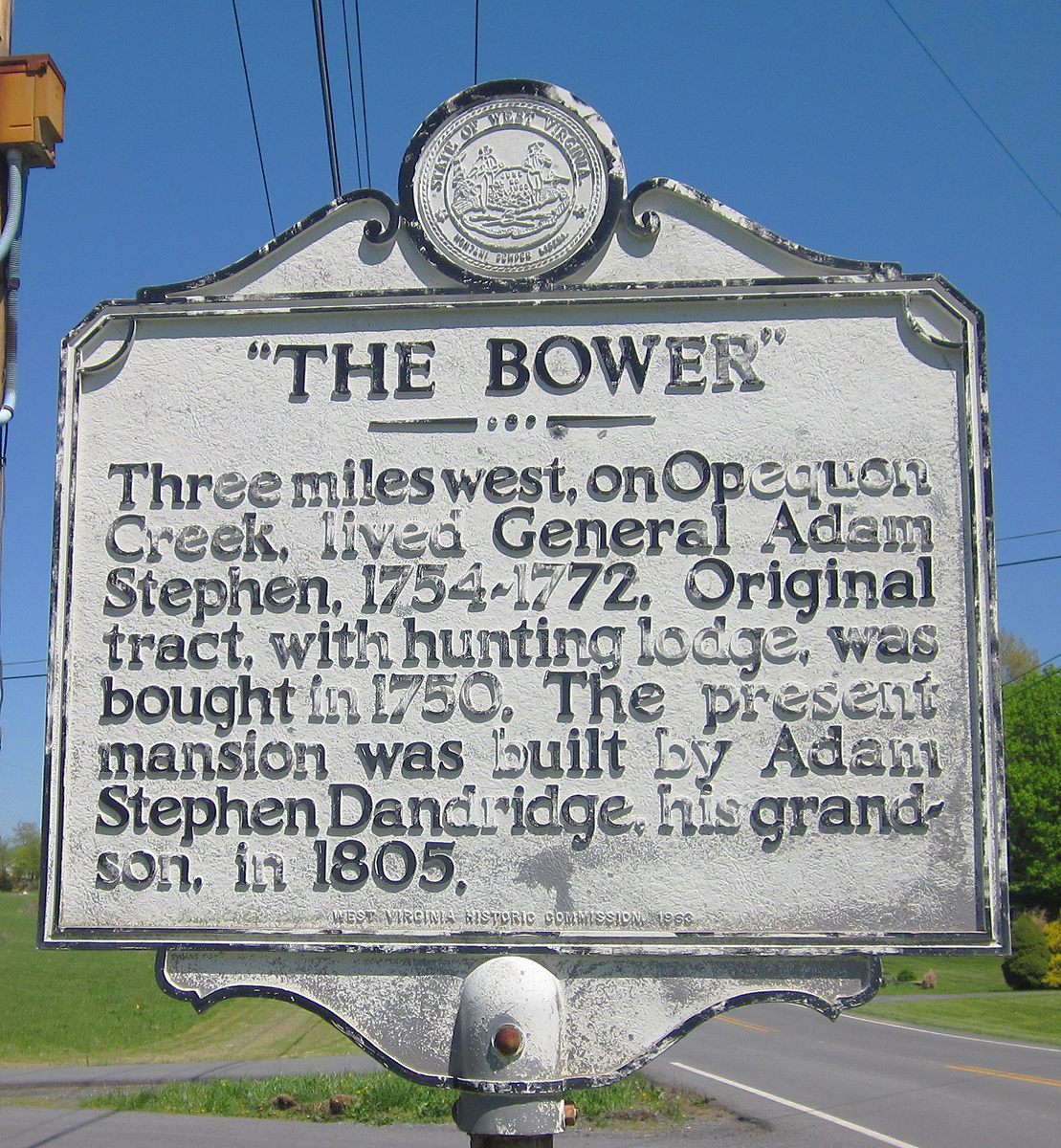
The Bower
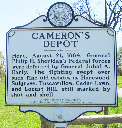
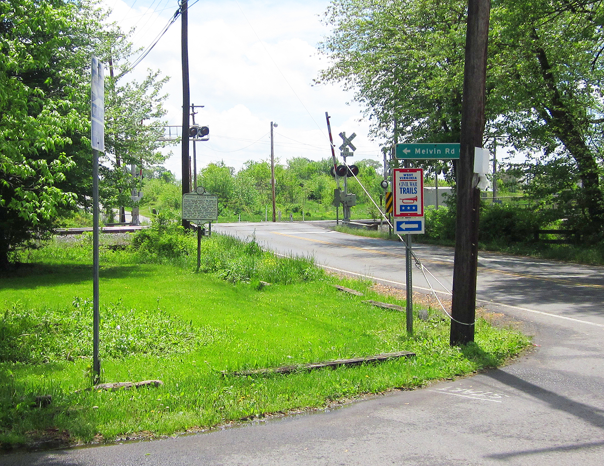
Cameron's Depot

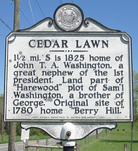
 Cedar Lawn
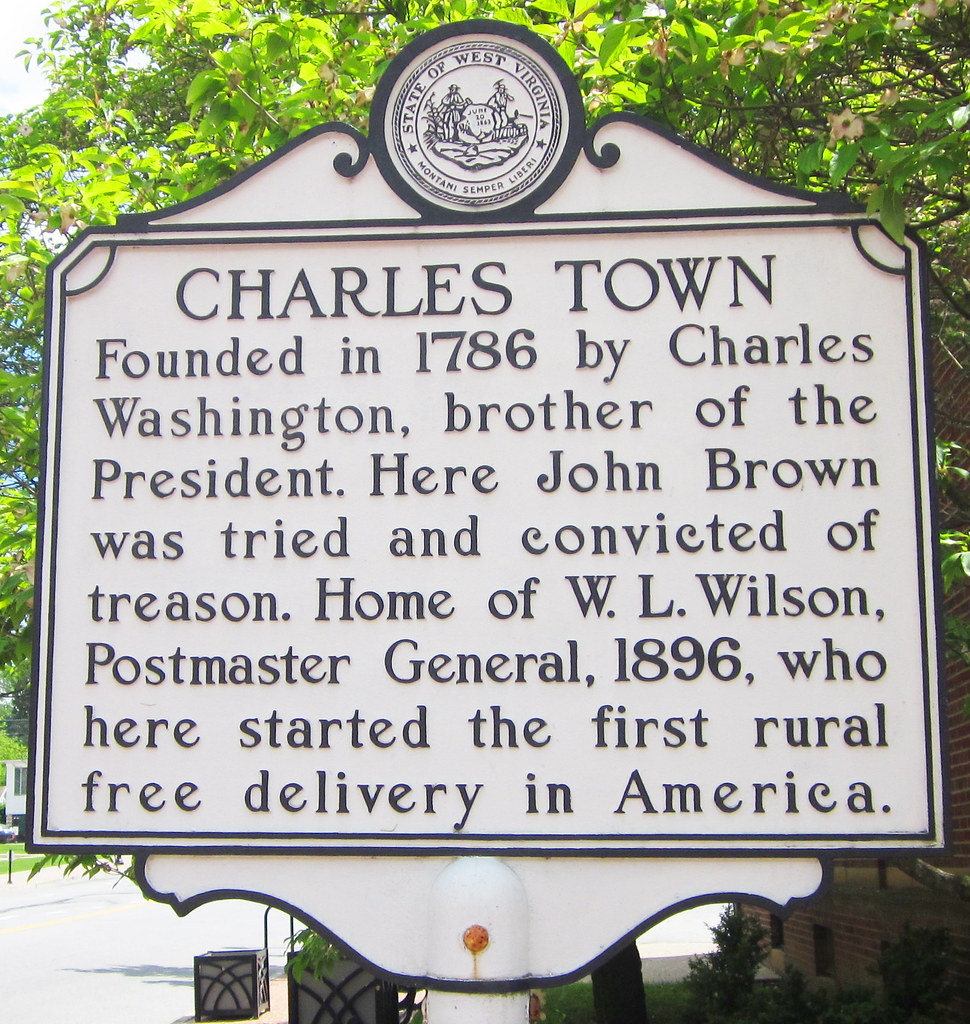
Charles Town
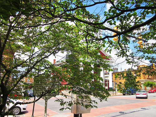

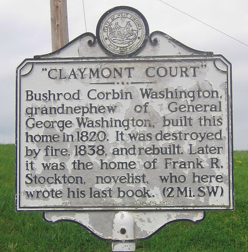
Claymont Court
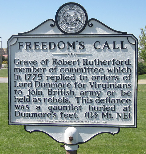
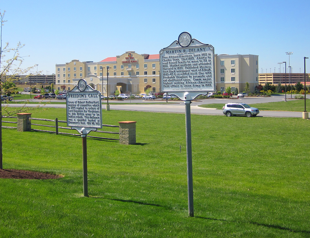
Freedom's Call
(two locations)
the old marker
&

and the new
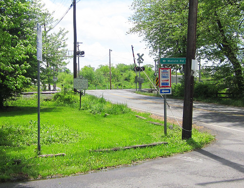
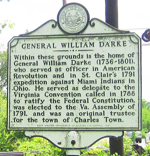
General William Darke
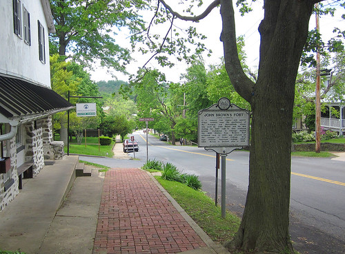
Harpers Ferry/John Brown's Fort
~~~~~
Happy Retreat
~~~~~
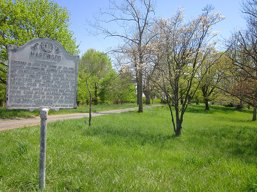
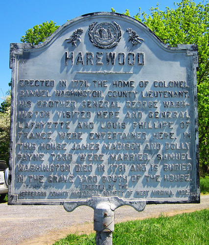
Harewood
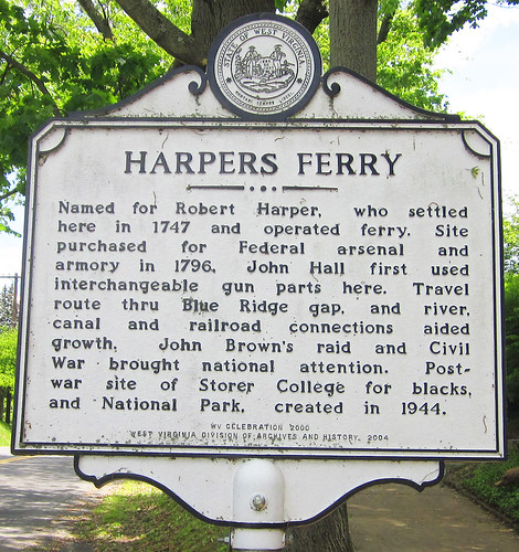
Harpers Ferry
(reverse of the "John Brown's Fort" sign)
Iron Furnaces
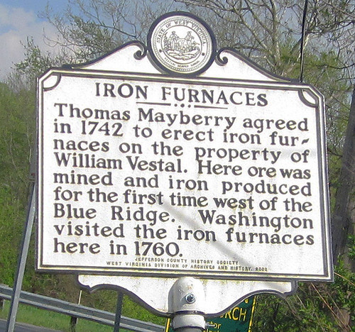
See also the Bloomery of Bloomery Road
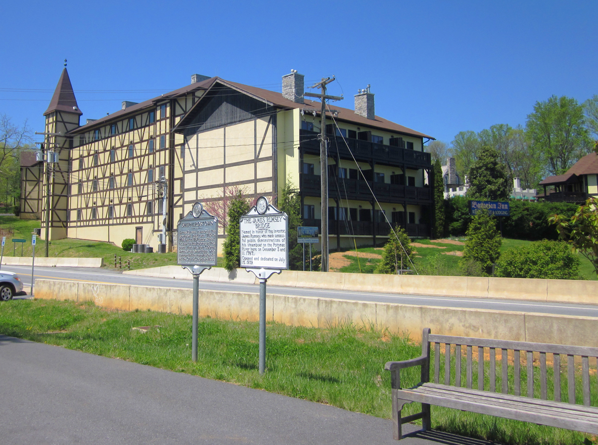
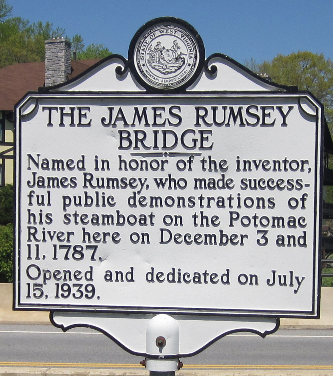
James Rumsey Bridge

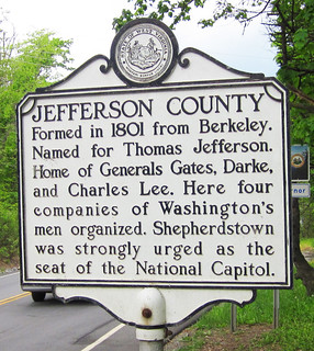
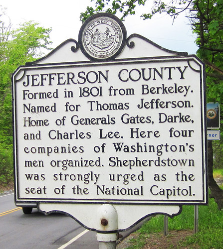
Jefferson County
(Note: there were possibly up to 7 markers titled "Jefferson County" at major roads entering the county. Some remain but several are missing. Can we find which are still standing?)
 The view west 4/2010 before the new bridge was built
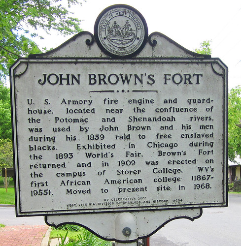
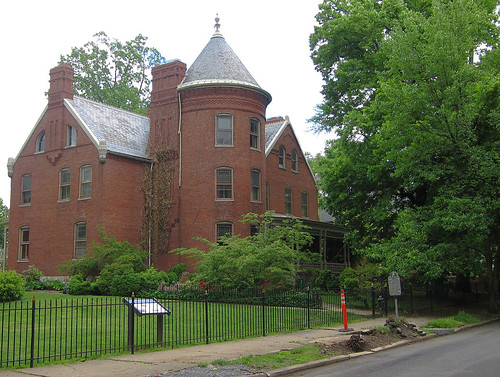
John Brown's Fort
 http://www.wvculture.org/history/jbexhibit/bbspr06-0010.html
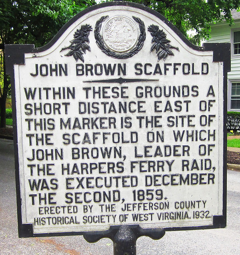
John Brown's Scaffold
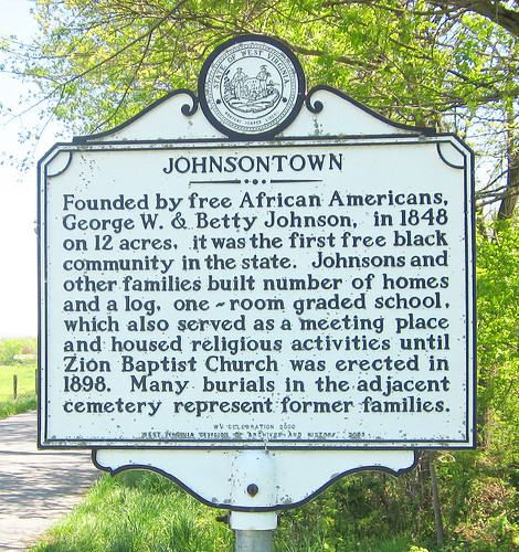
Johnsontown
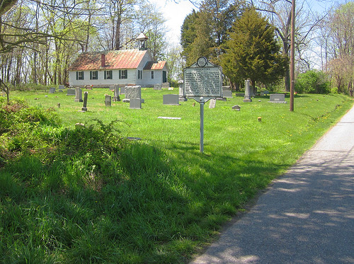
See also-Nicholas Roper: Johnsontown Cemetery
Keyes Gap
missing?-the sign read:
Formerly Vestal's Gap. Historic gateway through the Blue Ridge into the Shenandoah Valley. In 1755, part of Braddock's army passed here en route to Fort Duquesne. It was often used by Washington, and by armies of the Blue and the Gray, 1861-65.
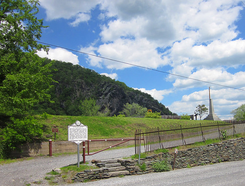
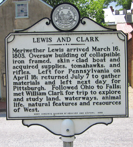
Lewis and Clark
Locust Hill
~~~~~
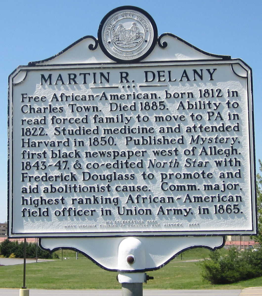
Martin Delany

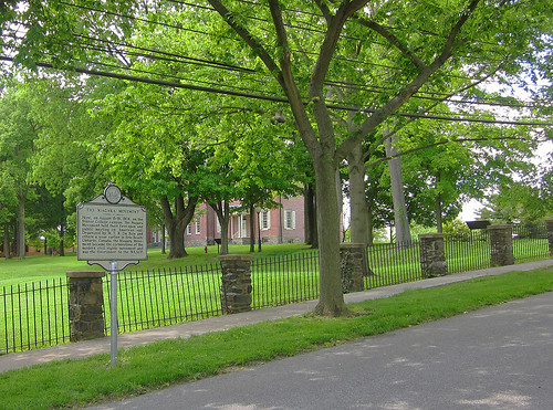
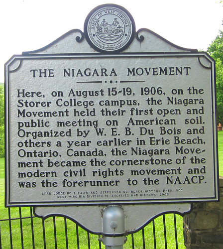
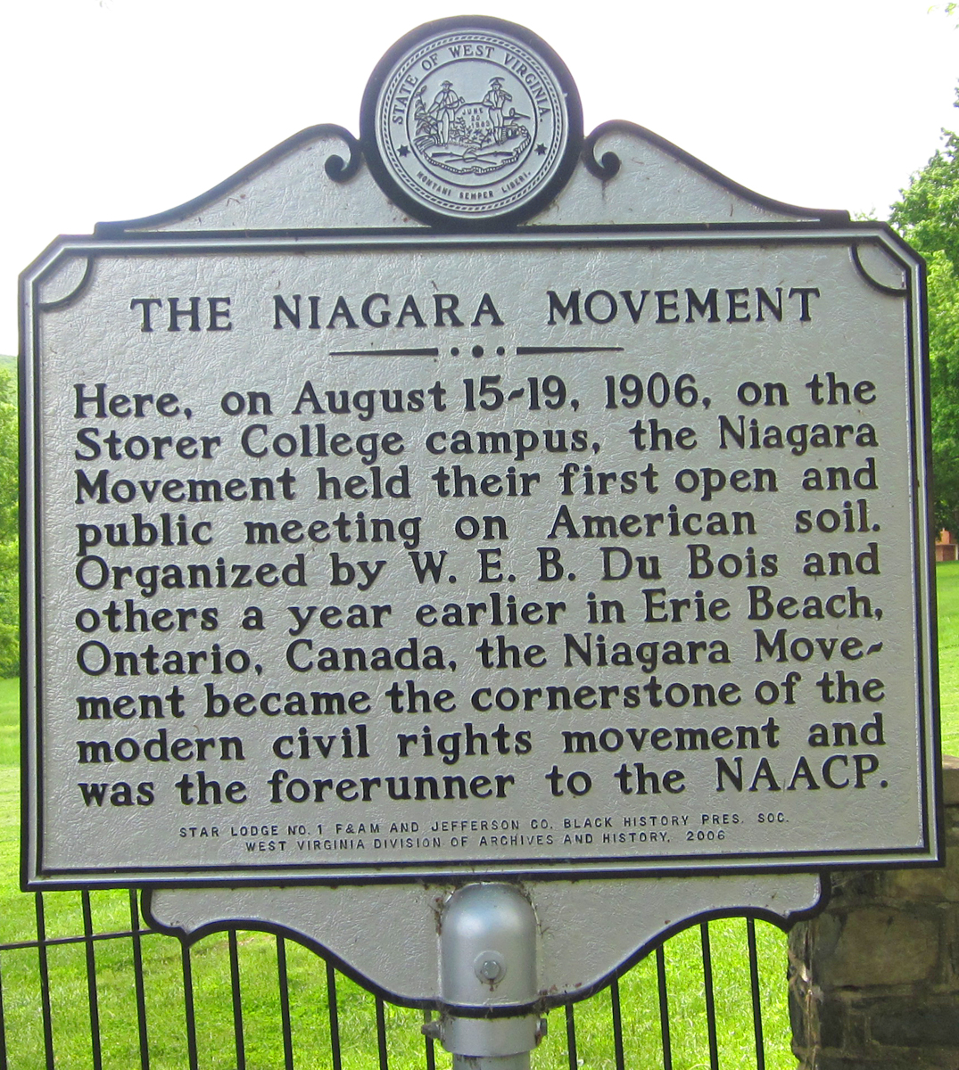
The Niagara Movement
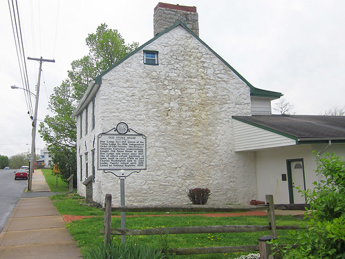
Old Stone House
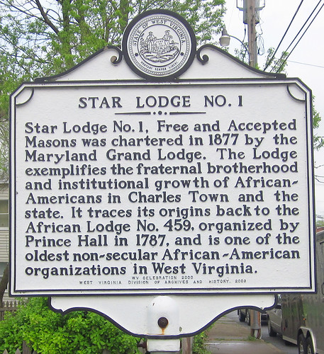
(Reverse/Star Lodge No. 1)
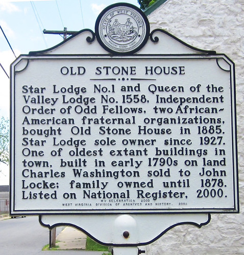
And Star Lodge No. 1 on the sign's reverse:

The Old Stone House
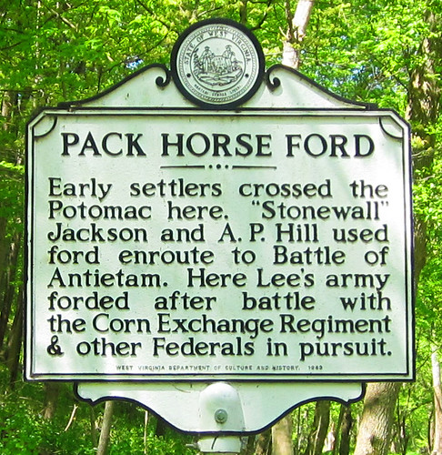
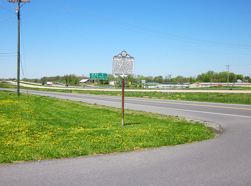
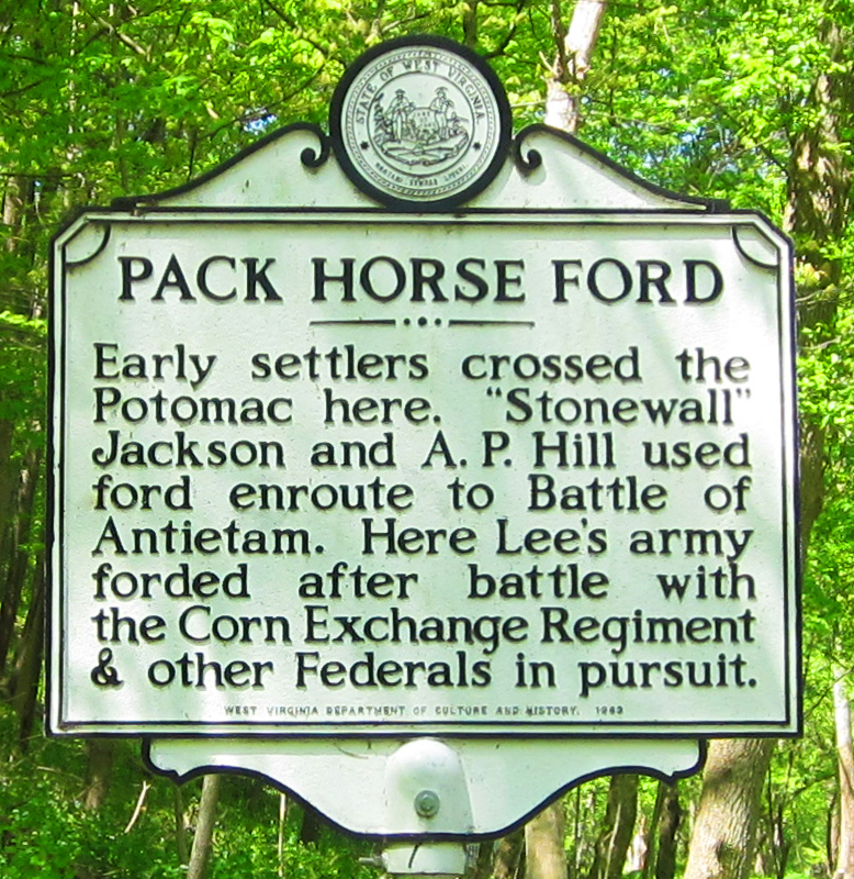
Pack Horse Ford
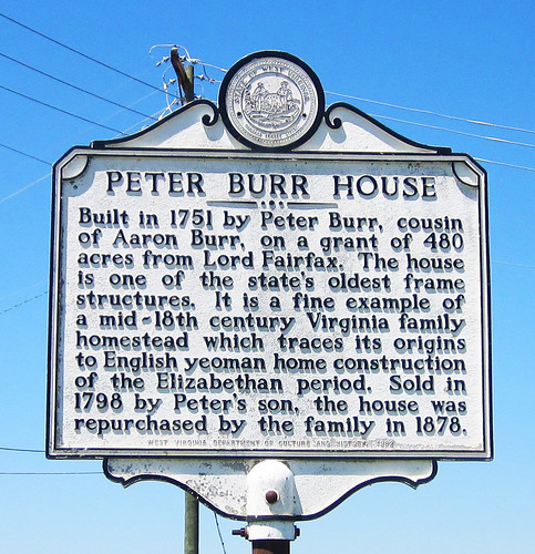
Peter Burr House
See Artisan Bread Making/Baking
Piedmont
Missing-The sign read:
Robert Worthington settled here in 1730 and built stone house called "Quarry Bank" after his family home in England. Son Robert Jr. helped establish nearby St. George's Chapel in 1769. James Nourse bought tract, known as "Piedmont," in 1770, and deeded it in 1786 to John Briscoe, who added present brick mansion to stone kitchen. It remained in family until 1979 death of Louise Briscoe.
Prato Rio
(post only?)
The sign read:
Home of General Charles Lee, built on land bought in 1774. Lee, colonel in British army, resigned his commission and joined the colonists after Battle of Lexington. On this estate, the U. S. Government maintains a fish hatchery.
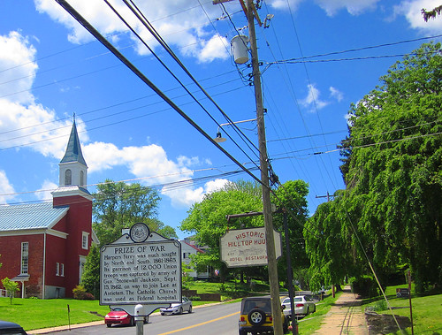
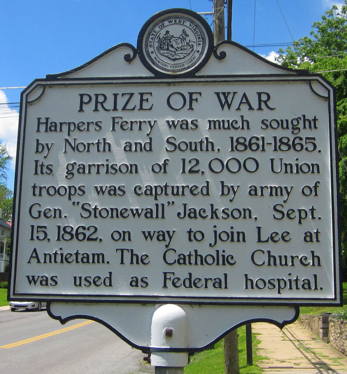
Prize of War

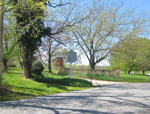
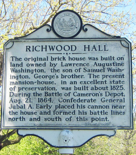
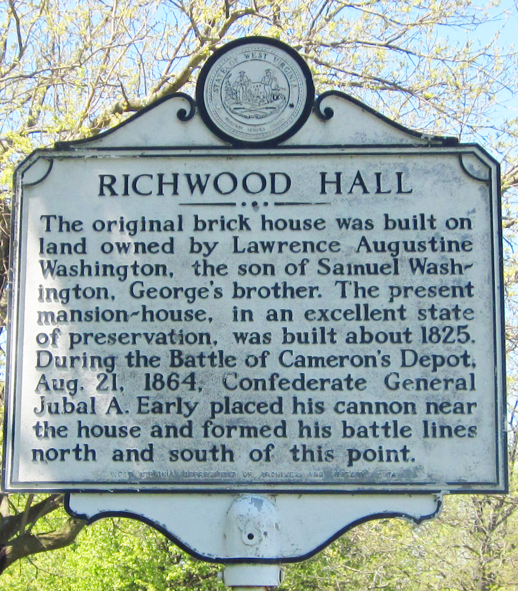
Richwood Hall
Shepherd College/University
~~~~~
Shepherd State Teachers' College
~~~~~
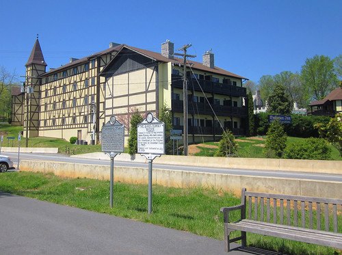
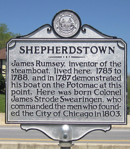
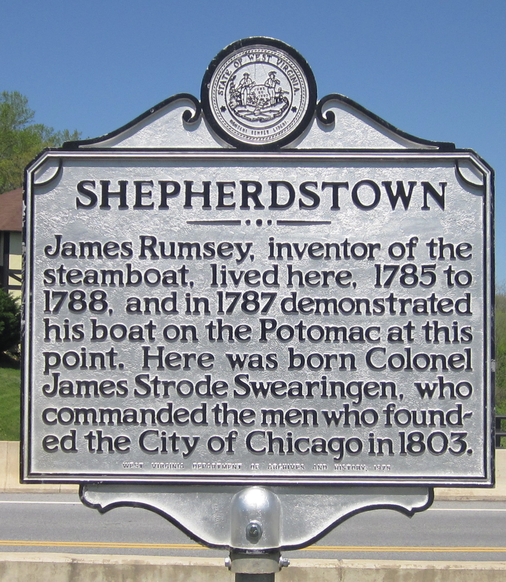
Shepherdstown
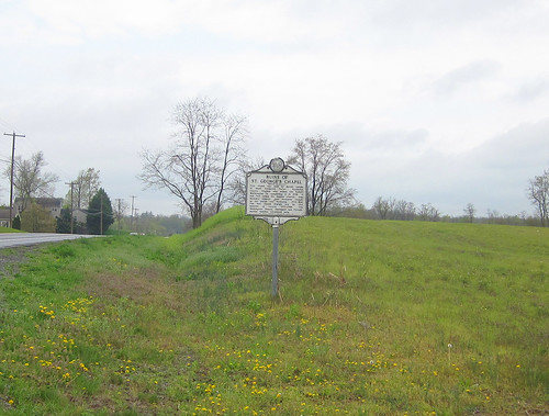
Ruins of Saint George's Chapel

Star Lodge #No. 1
(see old stone house above)
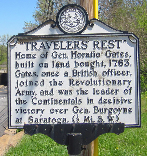
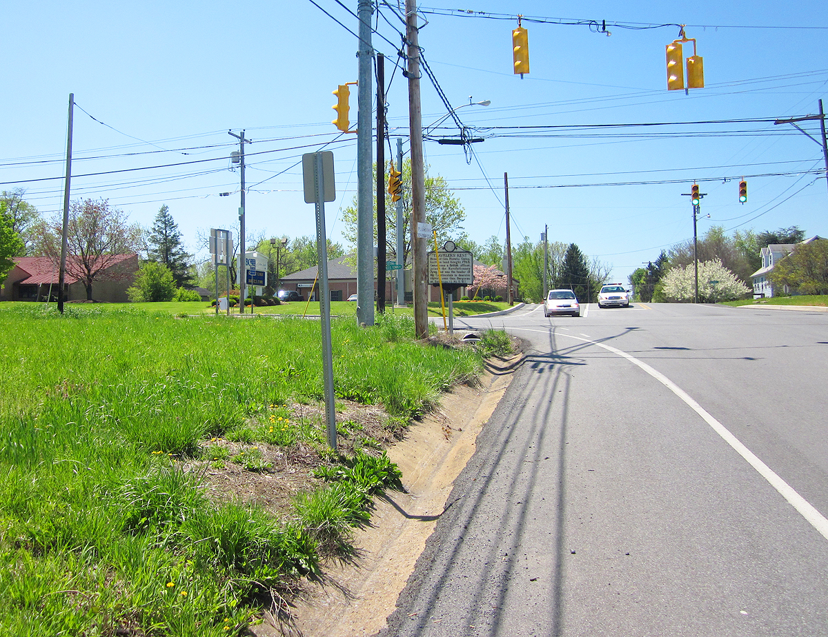
Travelers' Rest
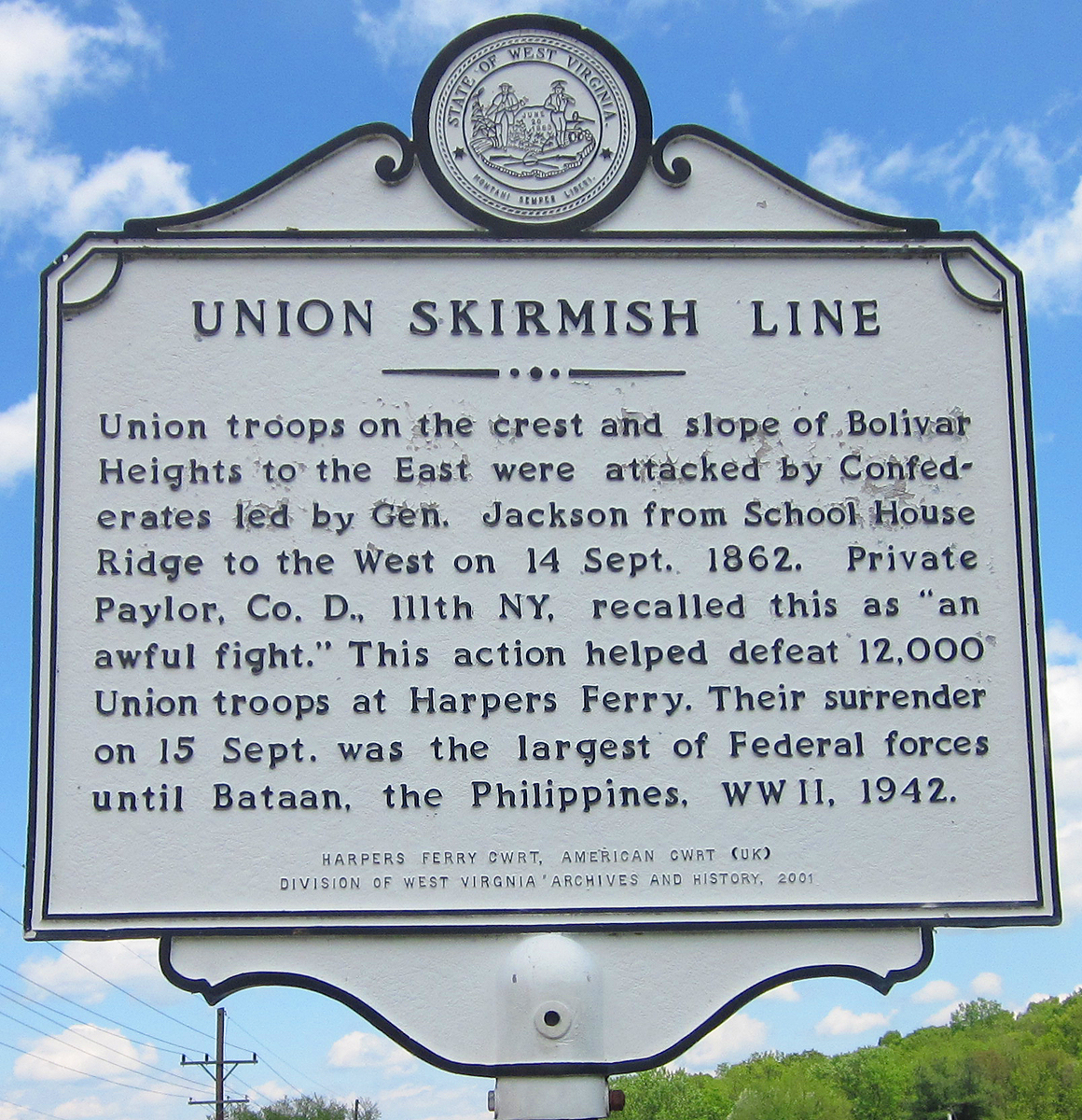
Union Skirmish Line

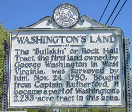
Washington's Land

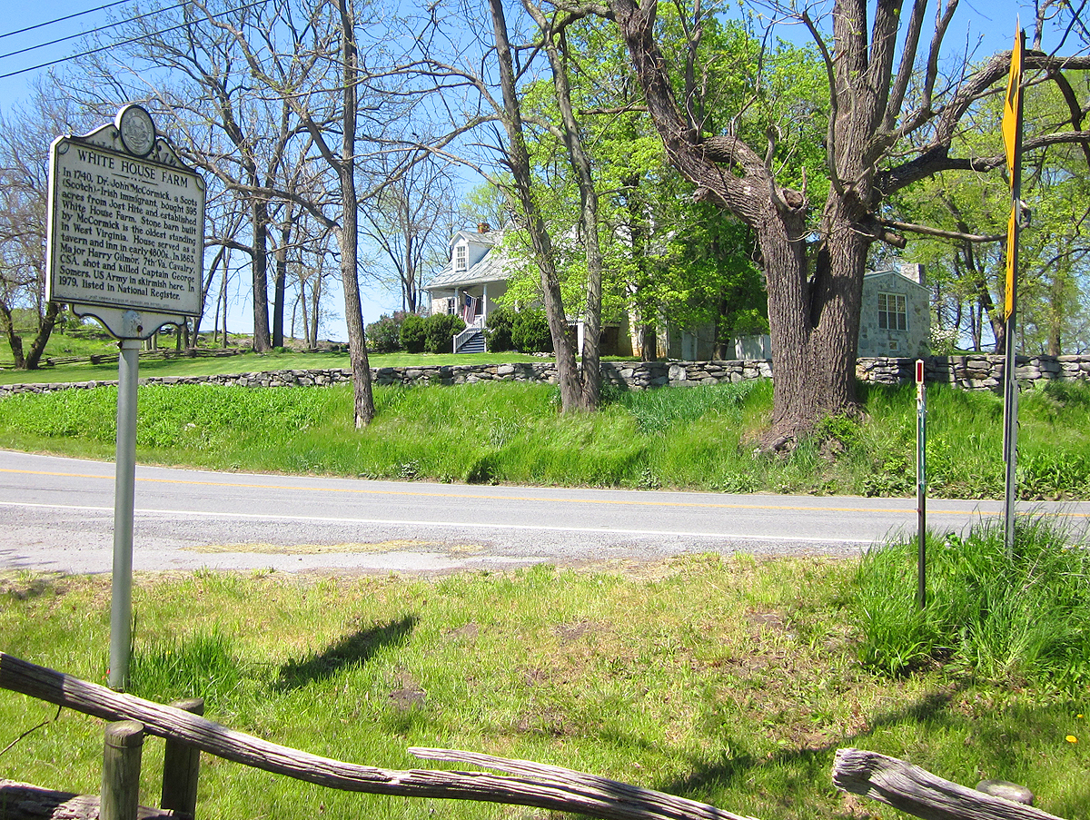
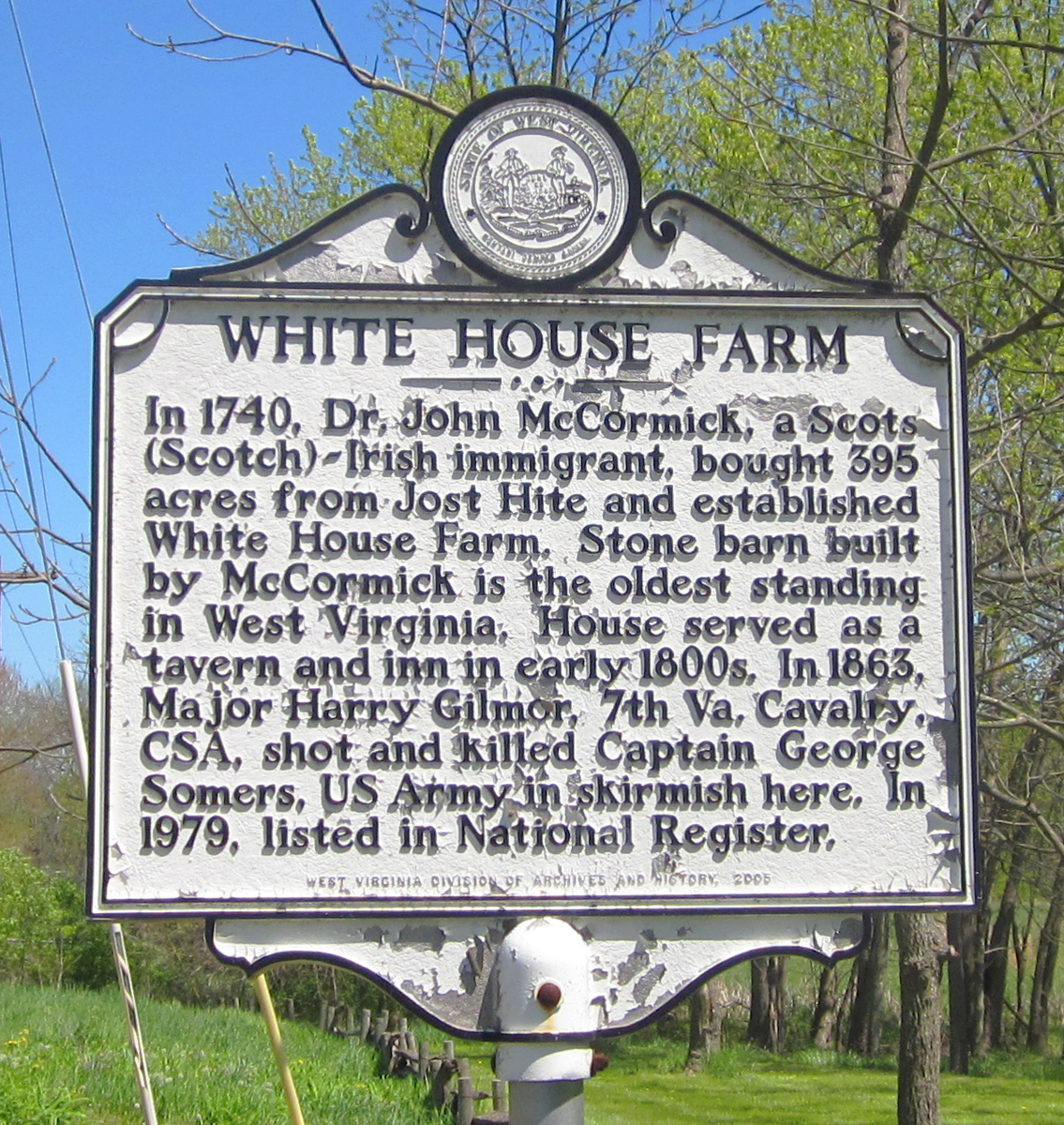
White House Farm


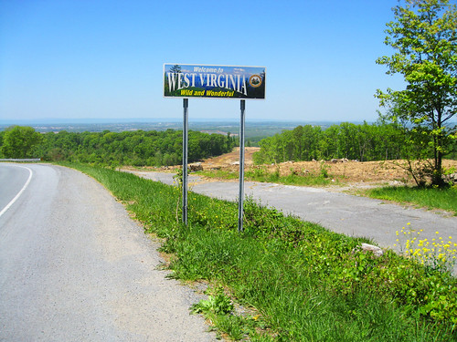
West Virginia
(Note: there were 2 markers titled "Jefferson County" on roads entering the county. One is reported missing. Can we find the one still standing?)
We're asking for your help. Do you know where markers are located which we haven't listed or found above? The ultimate goal of this project would be to take GPS coordinates and pinpoint the markers and the sites to which they refer on a self-guided tour map. Also, it would be dandy to add information, photos and links to the descriptions.
There are many more historic sites than the West Virginia Highway Historical Marker Program has commemorated with these impressive (and expensive: approx. $2000 installed) cast aluminum signs. You can view a list of some HERE.

They Sometimes Blend Into The Background
What are they all about, where are they located throughout our County, and what the heck do they say?
Shucks, you never have time to read them when you're driving by.We reckon the best way to describe the the markers would be to borrow the wording from the
West Virginia Division of Culture and History's website:
The West Virginia Highway Historical Marker Program was initiated in 1937 as part of the New Deal as a way to encourage tourism during the Great Depression. The West Virginia Commission on Historic and Scenic Markers worked with the State Road Commission, Works Progress Administration, and Federal Emergency Relief Administration to place 440 markers during the first year alone. After World War II, markers were placed at the sites of most state-run facilities and schools. The West Virginia Historic Commission took over the program in 1963. Since the late 1960s, the program has been managed by West Virginia Archives and History, which is today part of the West Virginia Division of Culture & History.
We've noticed the markers as we're sure you have. Some are in good condition, some are nearly illegible, and some are MIA. Many are in places some distance from the historical sites they describe. We're on a quest to find all that remain. You are invited to join in the hunt. We'd like a photo of the marker from a distance, a closeup that can be easily read (if it's not illegible), and a photo of the site that it references (if applicable).
We'll arrange them alphabetically for the time being waiting for a better suggestion.
Bellair
Blakeley

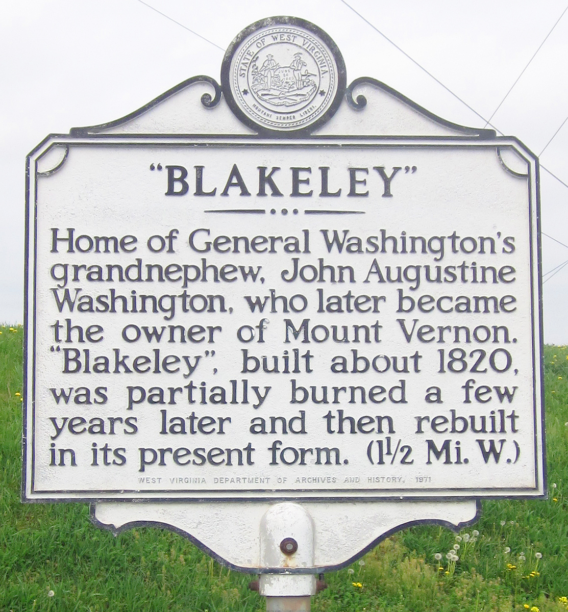

Blakeley from Wikipedia
The Bower

Cameron's Depot

Charles Town

Claymont Court

Freedom's Call
(two locations)

the old marker
&
and the new

General William Darke

Harpers Ferry/John Brown's Fort
~~~~~
Happy Retreat
~~~~~
Harewood


Harpers Ferry
(reverse of the "John Brown's Fort" sign)

Iron Furnaces


See also the Bloomery of Bloomery Road
James Rumsey Bridge
Jefferson County
(Note: there were possibly up to 7 markers titled "Jefferson County" at major roads entering the county. Some remain but several are missing. Can we find which are still standing?)

 The view west 4/2010 before the new bridge was built
John Brown's Fort
 http://www.wvculture.org/history/jbexhibit/bbspr06-0010.html
John Brown's Scaffold


Johnsontown


See also-Nicholas Roper: Johnsontown Cemetery
Keyes Gap
missing?-the sign read:
Formerly Vestal's Gap. Historic gateway through the Blue Ridge into the Shenandoah Valley. In 1755, part of Braddock's army passed here en route to Fort Duquesne. It was often used by Washington, and by armies of the Blue and the Gray, 1861-65.
Lewis and Clark


Locust Hill
~~~~~
Martin Delany
The Niagara Movement

Old Stone House
(Reverse/Star Lodge No. 1)


And Star Lodge No. 1 on the sign's reverse:

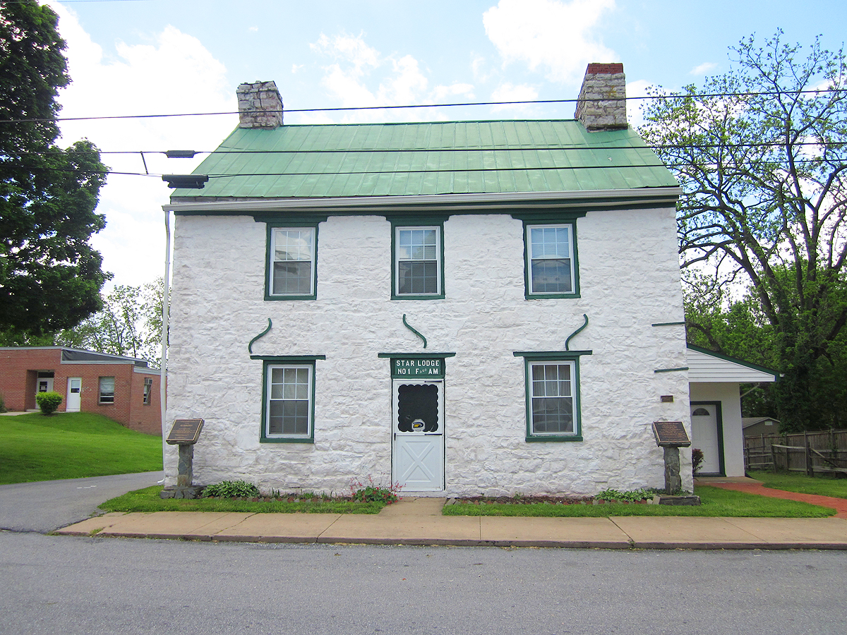
The Old Stone House
Pack Horse Ford

Peter Burr House


See Artisan Bread Making/Baking
Piedmont
Missing-The sign read:
Robert Worthington settled here in 1730 and built stone house called "Quarry Bank" after his family home in England. Son Robert Jr. helped establish nearby St. George's Chapel in 1769. James Nourse bought tract, known as "Piedmont," in 1770, and deeded it in 1786 to John Briscoe, who added present brick mansion to stone kitchen. It remained in family until 1979 death of Louise Briscoe.
Prato Rio
(post only?)

The sign read:
Home of General Charles Lee, built on land bought in 1774. Lee, colonel in British army, resigned his commission and joined the colonists after Battle of Lexington. On this estate, the U. S. Government maintains a fish hatchery.
Prize of War

Richwood Hall

Shepherd College/University
~~~~~
Shepherd State Teachers' College
~~~~~
Shepherdstown
Ruins of Saint George's Chapel


Star Lodge #No. 1
(see old stone house above)
Travelers' Rest

Union Skirmish Line

Washington's Land
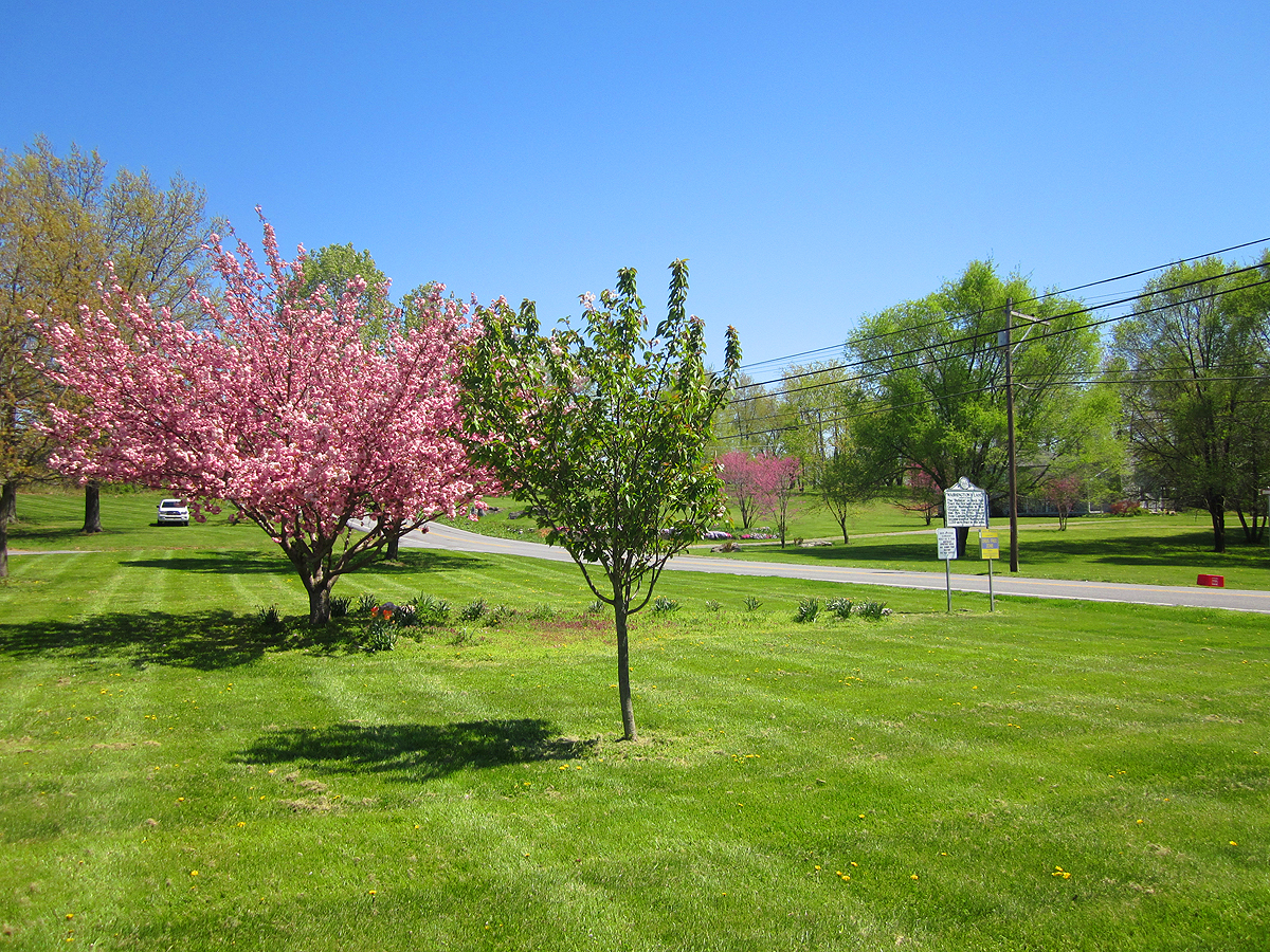

White House Farm
West Virginia
(Note: there were 2 markers titled "Jefferson County" on roads entering the county. One is reported missing. Can we find the one still standing?)
We're asking for your help. Do you know where markers are located which we haven't listed or found above? The ultimate goal of this project would be to take GPS coordinates and pinpoint the markers and the sites to which they refer on a self-guided tour map. Also, it would be dandy to add information, photos and links to the descriptions.
There are many more historic sites than the West Virginia Highway Historical Marker Program has commemorated with these impressive (and expensive: approx. $2000 installed) cast aluminum signs. You can view a list of some HERE.